subsurfaceAI for Geophysicists
Elevate Your Seismic Interpretation Workflow
Introducing subsurfaceAI for Geophysicists, an integral component of the subsurfaceAI 2024 release. This advanced package equips geophysicists with all the essential and advanced attribute functions needed to complete a comprehensive 2-D and 3-D seismic interpretation workflow. Remarkably, it operates without the need for a high-end NVIDIA graphics card, making it more accessible while still delivering powerful performance.
Integrated Visualization Environment
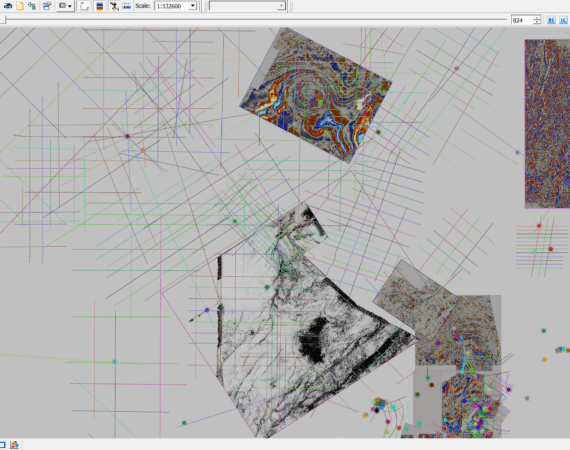
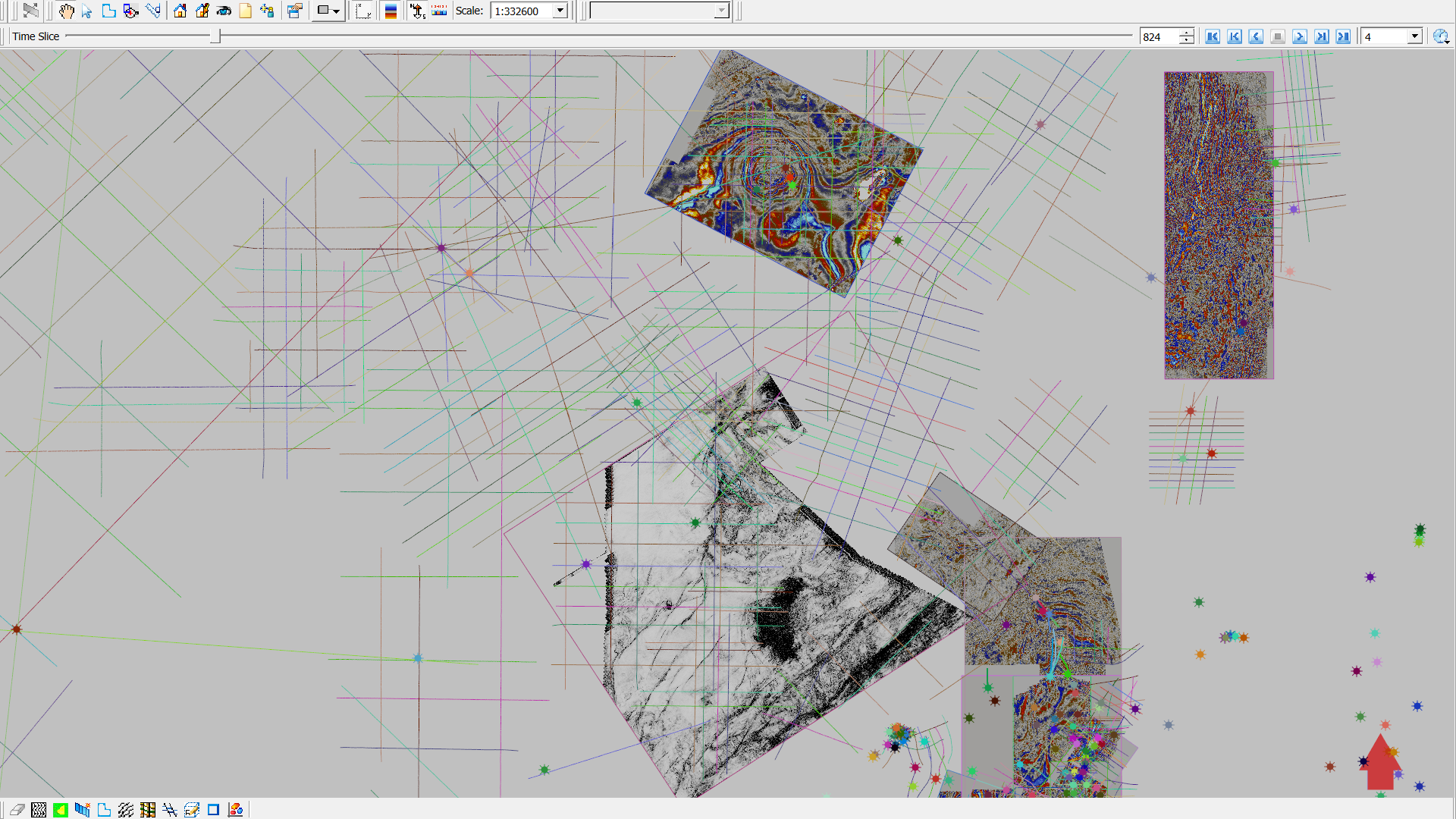
All seismic interpretation and mapping functions are built into an integrated visualization environment, featuring 15 types of 2-D and 3-D windows. This setup allows for immediate quality control of your interpretation and attribute analysis results, enhancing accuracy and efficiency.
Comprehensive Seismic Interpretation Workflow
With subsurfaceAI for Geophysicists, you can execute a complete 2-D and 3-D integrated seismic interpretation and attribute analysis project through the following workflow:
Workflow
- Import Seismic Data: Easily import multiple 2-D and 3-D seismic datasets into your project, with support for worldwide geographic projections.
- Import Well Data: Seamlessly integrate well data, including well headers, directional surveys, well logs, and existing well top interpretations in various formats.
- Incorporate Existing Interpretations: Utilize available 2-D and 3-D horizon picks, fault sticks, and other seismic interpretation results.
- Integrate Culture Data: Import cultural data in geographic data formats for comprehensive analysis.
- Seismic Survey Alignment: Correct for differences in time, amplitude, and frequency across different seismic data vintages.
- Identify New Reservoir Targets: Detect new reservoir targets through well top or well log facies interpretation on well sections.
- Well and Seismic Data Correlation: Tie well data to seismic data using synthetic seismograms and match well tops with seismic horizons.
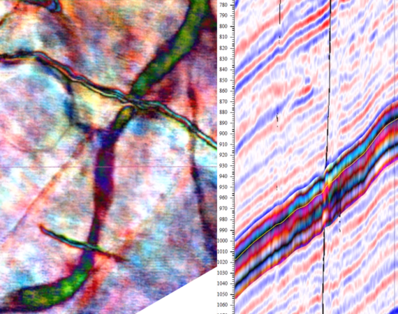
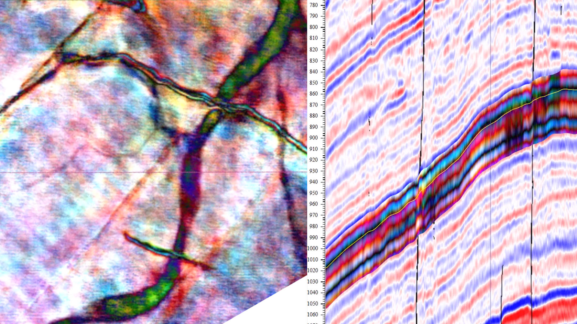
- Seismic Data Conditioning: Enhance signal-to-noise ratio through edge-preserving noise filtering, PCA analysis, and image enhancement before attribute calculation.
- Attribute Calculation: Compute various seismic attributes, including fault likelihood, semblance, volume curvatures, instantaneous attributes and spectral decompositions.
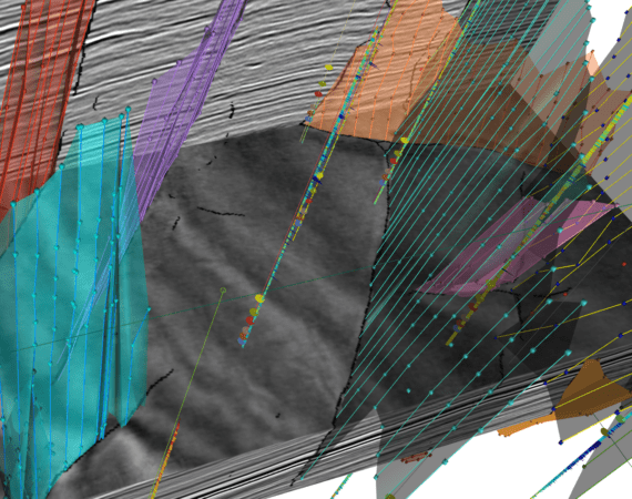
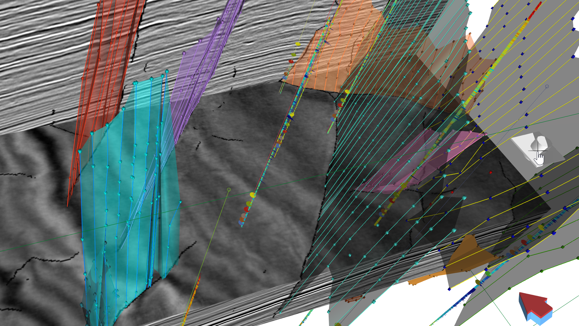
- Fault Picking: Identify faults on seismic sections, base maps, or 3-D windows.
11. Horizon Picking: Select seismic horizons of interest using auto-tracking with flexible editing functions, constrained by fault attributes or existing interpretations.
12. Strata-Grid Construction: Build strata-grids or interval grids in zones of interest and visualize stratigraphic features through strata-slicing.
13. Enhanced Visualization: Co-render or RGB color blend selected iso-amplitudes for enhanced attribute interpretation and visualization.
14. Geobody Picking: Extract geobodies from seismic attribute volumes interactively or through defined attribute criteria, with volumetric and OOIP calculations.
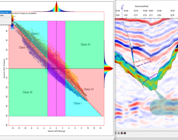
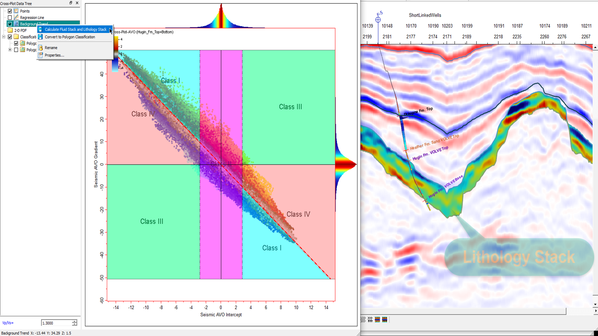
15. Interactive Cross Plots: Utilize 2-D and 3-D cross plots to define facies classes, project samples, and save results as facies objects.
16. AVO Attribute Generation: Generate and analyze AVO attributes from partial stacked volumes, with interactive facies classification.
17. Waveform Correlation Maps: Create correlation maps at locations without well controls, generating seismic class type maps from multiple correlation maps.
18. Velocity Model Building: Construct velocity volumes from strata-grids that honor stratigraphic layering.
19. Time-Depth Conversions: Perform time and depth domain conversions using activated velocity models.
20. Map Generation: Generate and export maps in GeoTiff format for further analysis or plotting in other mapping packages.
Seamless Integration with Advanced AI Solutions
All workflows can be performed interactively in a visual environment. Additionally, you can enhance your interpretation and reservoir property prediction by integrating IntegrationAI and InterpAI into the same project, given the availability of licenses.
subsurfaceAI for Geophysicists empowers you with the tools needed to perform accurate, consistent, and efficient seismic interpretations. Elevate your subsurface exploration and maximize the potential of your seismic data with subsurfaceAI for Geophysicists.